Monday, July 10, 2017

Two long days and two short nights--Allens Pensacola Cay to Jacksonville


White Pepper was nearing the end of the season by early June. We had spent a delightful several weeks in the Abacos seeing old haunts and old friends. Sister, Susan, and niece, Emma, flew in for a whirlwind visit. We were able to have two long stretches at Treasure Cay, one in the company of new friends Bill and Mary Ellen from Sea Escape. Sandra and Jens from Kobald were able to stop by for one day at Marsh Harbor before tearing off through the Man-o-War Channel headed for the Chesapeake Bay. They made it 6 days later without problems.

However, the Bahamas in the summer is for power boaters who can quickly duck back to Florida or for sail boaters who have a credible hurricane plan. After all, Hurricane Matthew had just devastated this part of world only 10 months earlier.

Dreading another hot slog up the ICW White Pepper resolved to take the East Coast of Florida in one jump. In 2015 White Pepper had made a last stop at Grand Cay in the NW corner of the Bahamas before jumping off through the nearby Walker Cay Channel for the St. John's River. That trip worked out very well mostly because of a marvelous weather window. We wanted to try this route again.
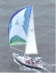
 Robert Briscoe

 Susan, Emma, and taxi driver

Sandra and Jens

Good friend, Robert Briscoe, flew in to help and get his first Gulf Stream crossing. A weather window opened up for the middle of the week. Although the winds would be from a favorable direction they could be too light. And thunder storms were likely as they almost always are this time of the year in Florida.
Fortunately, White Pepper, still had the extra diesel jerry cans from the Ragged Island trip. I calculated that if we could sail all of one day we could motor the rest of the way. If there was no wind, we had enough fuel to motor to Cape Canaveral.

White Pepper topped up fuel at Marsh Harbor, Great Abaco Island and there also filed a float plan over the internet with the US Customs and Border Patrol. The float plan would allow us to clear customs in Florida with only a phone call.
Next stop was Treasure Cay again, then around Whale Cay Passage to Allen's Pensacola Cay. We had to motor most of that day. From Allen's Pensacola Cay is possible to gain the Atlantic through a nearby passage, but we chose to stay on the Little Bahama Banks as long as possible. We headed West for Grand Cay about 50 miles away. The wind lightened and we again had to motor. About 4 miles short of Grand Cay White Pepper left the dotted line and headed for Walker's Channel. We elected to skip Grand Cay in order to get Robert back in time to catch a scheduled flight. 


Whale Cay from offshore

Hurricane Matthew may have moved some sand around last year changing the channel. However, by going from way point to way point as recommend in the Waterways Guide to the Bahamas, we never saw less than 11 feet depth. By coincidence we were leaving at low tide. However, I could clearly see some shallow spots between the center of this wide open channel and Little Walker's Cay several miles away.

Upon leaving the banks the wind picked up nicely and White Pepper could sail freely and fast. It was about 6:30 pm so we had 2 hours to settle down before sunset. A huge crackling thunderstorm started about 10 miles away. It slowly moved off to the North West away from us (traveling North by North West). The night watches were quiet, pleasant and passed quickly. By 3 am the stars and the nearly full moon were shining down as a gentle breeze pushed us along.

Dawn, the photo does not adequately show the subtle colors

My game plan was to cross the Gulf Steam in the morning before the thunderstorms picked up. So at dawn White Pepper started her motor and headed due West. We crossed the axis at noon in conditions so benign that Robert joked he would have to have a repeat trip to earn his stripes. The GPS was recording speeds of 8 to 10 knots. Later in the afternoon the wind filled in from the South West as predicted, and we could sail until sunset. There were thunderstorms in the distance, but none came close. From there on it was a brisk motor all the way to the St. John's River jetties. Part of the hurry was to arrive in time for the flooding current. We cleared the jetties at 1:30 pm with 2 or 3 knots of incoming current. We had done 240 miles in 32 hours. Curiously, on the St. John's River maximum flood current is at low tide and slack water is at mid tide. We were quickly carried up to Jacksonville docking at our regular spot in the free Jacksonville Municipal Marina. We tied up at 5:30 pm in the shadow of the Jacksonville Jaguars football stadium. This was almost 16 months after we had departed from the same slip so long ago. The next day was an easy motor, albeit in the rain, to White Pepper's haul out destination Green Cove Springs Marina.

Downtown Jacksonville, rain cloud overhead and Main Street Bridge in center.

This post may seem overly long and detailed, but I wanted to make some points for anyone planning a similar trip. First, get some north miles the first night, cross the Gulf Steam early on the second day, and finish the trip along the coast during the second night and early the next day. Also be mindful of the strong currents in the St. John's River. White Pepper was pleased to learn that Sea Escape followed the same route two weeks later with no problems.

 Favorable current

 The Q flag, barely needed with local boater's option at C&BP

Easy trip


Friday, June 9, 2017

Hawksville Cay, Exuma Land and Sea Park


Hawksbill Cay is the last major anchorage of the Exuma Land and Sea Park not visited by White Pepper. Located about half way between the popular stops of Shroud Cay and Waderwick Wells, Hawksbill is easy to skip. However, it has its own charms. White Pepper left Black Point and easily made Hawksbill after a pleasant sail. We picked up a mooring ball.

Southern Anchorage at Hawksbill Cay

Hawksbill has spectacular snorkeling, but the wind was too high to let us snorkel. Rather we explored the small island. There were several small beaches. The highest point of the island is marked by a large cairn and has a short trail. The view from the cairn is amazing.

 Selfie at the cairn

View from the cairn looking west, White Pepper on a mooring

The highlight of the visit was a trip up the tidal creek that pierces the island from the banks to close to the ocean. After landing the dingy Jan and I bush bashed through the palmettos for about a quarter of a mile to the Atlantic beach. After visiting the beach we got lost on the way back to the dingy and had to bash a fresh trail. The trip made me marvel at what a life the loyalist settlers must have had when they briefly inhabited this island in the late 18th century.

 Tidal creek near high tide

 Eastern side of Hawksbill

 Looking back to the west over the creek

 Atlantic side of Hawksbill after a short bush bash

Exiting the creek


Wednesday, May 31, 2017

Sout' Side of Great Exuma


White Pepper has long been fascinated by the back side of Great Exuma Island or the sout' side as the locals call it. Its virtues are extolled in the Explorer Chartbook (Exuma and Ragged Islands, sixth edition, page 56). Few cruisers go there although friends Ken and Connie on Oz transited in 2015.

While at Flamingo Cay we spoke with a fisherman from Spanish Wells. He said that the boat routinely went home by way of the Duck Rocks. By that he meant the Coakley Cay-Duck Cay cut. White Pepper was determined to give it try as it would mean a significant short cut over the old Comer Channel, Sandy Cay and the George Town route. It would in addition eliminate two trips into Exuma Sound although this time of year the Sound is rarely a problem.

White Pepper left Flamingo Cay and headed North Northwest across the Great Bahama Banks. The Explorer Chart proclaimed the area full of coral heads, but they were easily seen and avoided in the bright sunlight. There is one area of coral 5 miles south of Coakley Cay that is about 40 acres in extent and as little as six feet deep. It is well marked on the Explorer Chart and easily avoided. Most of the time we were in 20 feet of water.

We were fortunate enough to hit the Coakley-Duck cut at high tide and never saw less than eleven feet of depth which would be 8 feet at low tide. There are a few coral heads in the cut, but again they are easily seen when the sun is out.
The only anxiety is on the stretch between the Duck Cay way point and Rocky Point Cay. The water was only 8 feet deep at about half tide. The charted depth varies between 6 and 7 feet. The western side of the cut is marked by the Hawksbill Rocks which are difficult to see.

 Duck Cay
Hawksbill Rocks

Rocky Point was our halfway mark and anchorage for the night. One can anchor on either side so the only wind that is not protected is SW. Of course the wind that night was from the SW but so light that we were not disturbed.

Rocky Point

The next leg of our course was way out into the banks to a way point that was closer to the Tongue of the Ocean than to the Exuma Sound. This detour is to avoid the Galliot Banks. The wind had built and backed to the SSW which gave White Pepper a nice run under reefed genoa and no main sail. A gybe at the Galliot Banks way point took us to Little Farmer's Cay. Another gybe brought us to our destination at Black Point. White Pepper done 90 miles in two day sails. We never saw another sailboat during those two days and only one fishing boat on the banks.

This route is an excellent way to come north quickly from the Jumentoes if you do not need to stop at George Town to resupply. The Explorer Chart touts the route as a protected way to go south in the winter with Thompson's Bay, Long Island as a final destination. However, White Pepper felt exposed on this trip and would hate to try the passage in a hard northerly or northeasterly blow. It might even be worse in a brisk southerly breeze. Perhaps there is a good reason why cruisers chose the Exuma Sound by 100:1 over the banks route.

Tuesday, May 30, 2017

Jumentoes


White Pepper has long wished to visit the Jumentoes also known as the Ragged Island Chain. The Jumentoes are a chain of small windswept limestone out croppings that mark the southeastern edge of the Great Bahama Bank. The last island is Ragged Island where Duncan Town stands on a low ridge only 60 miles from Cuba. Cuba is actually closer to Duncan Town than George Town which is the next nearest habitation.

White Pepper visited the northern two islands, Water Cay and Flamingo Cay, in 2014 before turning back due to electrical and refrigeration problems.

The Jumentoes are uninhabited except for 60 souls hanging on at Duncan Town. There are no services, no water, no fresh groceries, no booze, no fuel, and no rescue. There are few places to ride out a frontal weather passage and no harbors with 360 degree protection. When the wind blows hard from the East the 8 mile wide Nurse Channel is impassable. White Pepper's plan for dealing with these difficulties was to wait until late Spring to visit when the weather is better. Finally we got a long spell of forecasted settled weather in early May.

This year we dropped anchor first at Water Cay after a long motor sail from George Town around Sandy Cay and through the Comer Channel at near high tide. 
The white bluffs at Water Cay

The next day dawned clear and calm—perfect conditions to transit the difficult Man of War Channel and Nurse Channel. During most of the day there were not even ripples on the water and the bottom was clearly visible. It was like motoring in our own private aquarium.

Sailing on top of our  own aquarium


After motoring about 40 miles and crossing the Nurse Channel the first stop was Buenavista Cay. Only one person, Ed Lockhart, lives on Buenavista Cay and we anchored just in front of his house. The house has been under construction for years. Ed was born and raised on the site. After many years he has returned to homestead and reclaim his family's heritage.

Ron and Ed Lockhart on Buenavista Cay

Buenavista Cay has the longest beach in the Jumentoes. We were able to walk most of it in one morning. However, by noon it was up anchor and on to our ultimate destination, Hog Cay, near Duncan Town. Our friends, Ron and Linda, on Escape from Reality were waiting for us at the Hog Cay Yacht Club, which is really just a nice halapa on the beach. Ed told us that he build the structure.

 The Hog Cay Yacht Club


Hog Cay hosts a regular contingent of cruiser's for most of the winter. As in George Town the cruisers have hacked out trails. We followed on of these through a pond and on to a perfect small beach on the Atlantic. After Hog Cay White Pepper headed north to the next cay, Raccoon Cay. Raccoon Cay turned out to be out favorite with beautiful beaches, great shelling and fantastic snorkeling off the beach.
 At Raccoon Cay with friends, note boats in the background

The Atlantic side of Hog Cay.  There was very little plastic on the beach probably due to the efforts of the winter cruisers.

We made another stop at Buenavista Cay and were able to meet Ed and his son. The next day had favorable tide and weather to recross the Nurse Channel although we had to leave at dawn. By leaving early we were able to anchor at Flamingo Cay at noon. During this leg White Pepper was challenged to an informal race by new friends, Yens and Sandra, on Kobald. 

Racing Kobald  in Man of War Channel

Flamingo Cay is known for spectacular snorkeling and its “dingy drive in” cave. We were fortunate to be able to spend two and half delightful days there in mild conditions.
 The dingy cave

 Inside the dingy cave near low tide

Jens and Sandra at Flamingo Cay in front of a pond.  The red color is due to a biological process.

For the trip back to the Exumas White Pepper went up the back side or sout' side which will be the subject of another post.
Treasures of the Beach


Thursday, May 25, 2017

Family Island National Regatta


This year was the 63rd Family National Island Regatta held in Elizabeth Harbor near George Town, Exuma, Bahamas. The first regatta was held in 1954 as a way to celebrate the end of fishing season. Originally the actual fishing sailing sloops were the race boats. Over the years the fishing boats were motorized; however, the sailing sloops were preserved and refined as race boats.


Tida Wave with two full pry boards


The sloops come in all sizes and race in 5 classes—A thru E. All have to look like traditional fishing sloops with long full keels, long booms, huge over canvassed mains, small jibs, and no winches. The most noticeable feature is a “pry board” which is run out to windward on every tack. Several men hike out on the board trying to hold down the overly large main sail.

Barbarian, a class C sloop, at the top mark.  Note the large main sail.

The Bahamians hold several of these regattas around the country at different islands, usually about one per month except December and January. However, the George Town regatta is the grand daddy of them all and is recognized as the national championship. The regatta also serves as an excuse to have a party/festival/homecoming for the locals. Large numbers of Bahamians crowd into town including the reviled “Nassau people.” We cruisers are cautioned to lock up everything when “those people” are in town. However, White Pepper, never encountered any unpleasantness during the four day festival.

The Police Band opens up the closing festivities.

On Wednesday there were stand alone races for each class. On Thursday, Friday, and Saturday there was a series. Classes C,D, and E started together every morning. These boats typically have a crew of between two and five. There were probably 30 boats on the line. Although the race is supposed to start at 9 am, in practice, it starts when everybody shows up and is ready. The class B start is nominally at noon. There were 10 boats on the line. This was the most closely contested race every day. These boats are about 30 feet long and carry a crew of between 5 and 8. Class A is later in the afternoon. The class A boats are spectacular. They are fast, powerful and graceful. They are 40 feet long and carry a crew of between 12 and 18 . Most of the large crew is used as shifting ballast. Some of the boats use two pry boards in parallel, stacking 8 men out on the boards. There were only 7 boats in class A. The start was easily the most interesting part of their race. After the start class A was largely a parade with the famous Tida Wave usually leading wire to wire.


Just after the start of race 2 for class A. Click on pictures for a better look.

The finish of race 2 for class A.  This was the only close finish for the class A boats with Tida Wave winning by a few seconds.


Rules change over the years for the Bahamian sloops, and I have not seen a complete set of rules. In the past skippers did not have to go back to pick up crew that accidentally or deliberately fell overboard. It is quite easy to fall off or get knocked off the pry board. Recently, that rule has changed to conform to the international rules. The most notable difference from yacht racing in the USA is that the boats start from an anchored position. When the gun goes off some of the crew pull on the anchor trying to get a little way on. The rest of the crew hauls up the sails without having the benefit of winches to tension the luff. The first sloop to get her sails full obviously has a huge advantage. The rest of the race proceeds much as a yacht race in America would except for the downwind legs. The boats proceed “wing and wing” downwind with huge mainsail out to port (always) and the small jib to weather which is always starboard. The pry board is used as necessary to balance the mail. The main sail on the Bahamian sloop is so large that jibing the boat would be unwise in any breeze at all. An accidental jibe might sweep men overboard and likely snap the mast. So the race course is always set up so that the downwind legs are on starboard board without jibes.

Class B boats running down to bottom mark, but no gybing.

I wish I could tell readers who won, but White Pepper did not go to the trophy presentation. The race committee has not yet discovered the internet. In class A Tida Wave from Staniel Cay certainly won for the 19th time (not an exaggeration) followed closely by Running Tide from Long Island. These two were clearly superior to the other five.  The racing was much more closely contested in class B.

Furious action in class B

Ashore there was plenty of activity. The city has constructeTd a new bulkhead at Regatta Park and behind that there is a new gravel covered field where shacks were constructed for a festival site.  The bulkhead was a surprise as it is rare these days for anything to get built and finished on time in the Bahamas. We spent most of Saturday at the Regatta Park or the Peace and Plenty Resort with friends soaking in the atmosphere and watching the races from ashore. Otherwise we were out in the dingy, Habanero, taking in the races from various vantage points around the course.

The new bulkhead and some class E dingies

'Da Peoples Choice' was our go to shack for beer and lunch.
Over all it was a very interesting and successful regatta week.

The Good News, a class A sloop from the Ragged Islands

Monday, May 15, 2017

Driving Long Island


White Pepper is anchored at Salt Pond, Long Island waiting on gentler winds. We are perfectly comfortable in these protected waters but have a lot of time on our hands.

One day we choose to tag along with our friends Ron and Linda from Escape from Reality on a rented car excursion.

Long Island is 90 miles long and we certainly could not see it all in one day. After some discussion we headed north for the Columbus Monument on Cape Santa Maria. Columbus may have anchored under the white bluffs of this modest cliff. From his log book he certainly seemed to have visited Long Island and cruised the its coast before being blown over to French Wells on Crooked Island. In order to commemorate the event in 1492 and maybe encourage more tourism, the Bahamians have erected a monument atop Cape Santa Maria on the northern most tip of Long Island.

Alert readers will remember the Columbus Monument from a picture in the previous post. The monument is barely visible from sea. Thus we were unprepared for the awesome beauty of the place. Pictures can tell the tale better than words.

Columbus Bay

Columbus Monument

View to the South from the Monument

For lunch we visited the Stella Maris Resort which is about 15 miles south down the Queen's Highway. By the way the Queen's Highway is the only highway on the island. Stella Maris is routinely described in guide books as world class and 5 star, but it seemed a bit threadbare to my eye. We did have a lovely lunch there.


Easily the number one attraction on Long Island is Dean's Blue Hole—the site of the world's record for free diving. The blue hole is part of a beautiful bay that comes off of the Atlantic. The bay and beach are attractive in their own right, but the blue hole engenders a different feeling altogether. Although only 80 x 120 across on the surface it goes down for 680 feet—the equivalent of a 40 story building. Also it has claimed a number of lives due to accidents and dare deviltry.

                                                               Dean's Blue Hole

Finally we finished up a great day with a couple of beers and conch fritters at Max' Conch House and Bar in Deadman's Cay.


Friday, April 7, 2017

Calabash Bay, Long Island and Joe's Creek


White Pepper has been to Calabash Bay several times over the years and has many happy memories of the place. So it was with anticipation that we hauled past Cape Santa Maria and into Calabash Bay on the northern tip of Long Island. This was the third spot Columbus was reported to have visited in the New World. Conception Island was the second. Calabash Bay is 20 miles or so from George Town. It was made famous by Bruce van Sant as the first spot on a “Gentleman's Guide to Passages South”-- that is the trip from George Town, Bahamas to Lupron, DR. It is rolly and exposed to every wind except the prevailing Southeasterly.

Cape Santa Maria. One can barely see the Columbus Monument on top of the cliff.

We sighted on the famous Yellow House at the south end of the anchorage to avoid the fringing reef and anchored in 9 feet of crystal clear water over sand.

Yellow House

White Pepper's reasons for stopping at Calabash Bay were to show guest, Barb Mathis, another beautiful spot in the Bahamas and to explore Joe's Creek. Joe's Creek is a deep and wide creek with 360 degree protection just one mile south of Calabash Bay. We have always heard and read about this anchorage but were deterred from visiting by the entrance. We set out to explore by dingy. Indeed the entrance is formidable being only 6 feet deep at low water and about 30 feet wide with rocky shore on both sides. Today the entrance was peaceful. Once inside White Pepper was treated to an idyllic Bahamas scene of swiftly flowing deep and clear water over sand. There seemed to be plenty of space to anchor numerous boats. White Pepper may someday bring the big boat there at slack tide high water and when there is no swell running in Exuma Sound.

 Entrance to Joe's Creek

 The Captain Max on a bad day

Wide and deep.  Plenty of room to anchor once inside Joe's Creek

If Joe's Creek was a place to hide and get away from civilization, then on the other end of Calabash Bay was one of the refinements of civilization—the Cape Santa Maria Club. This is a high end resort that competes with the near by and world famous Stella Maris resort. Rooms start at $400/night. However, they welcome scruffy cruisers in dingies. White Pepper went there with fellow cruisers, Ron and Linda from Escape from Reality, for lunch. We all had a relaxed and delicious meal. The contrast to the wilderness of Joe's Creek could not have been more vivid.


Very civilized lunch at Cape Santa Maria Club

Sunset over Calabash Bay