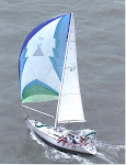
White
Pepper has long been fascinated
by the back side of Great Exuma Island or the sout' side as the
locals call it. Its virtues are extolled in the Explorer Chartbook
(Exuma and Ragged Islands, sixth edition, page 56). Few cruisers go
there although friends Ken and Connie on Oz
transited in 2015.
While
at Flamingo Cay we spoke with a fisherman from Spanish Wells. He
said that the boat routinely went home by way of the Duck Rocks. By
that he meant the Coakley Cay-Duck Cay cut. White Pepper
was determined to give it try as it would mean a significant short
cut over the old Comer Channel, Sandy Cay and the George Town route.
It would in addition eliminate two trips into Exuma Sound although
this time of year the Sound is rarely a problem.
White
Pepper left Flamingo Cay and
headed North Northwest across the Great Bahama Banks. The Explorer
Chart proclaimed the area full of coral heads, but they were easily
seen and avoided in the bright sunlight. There is one area of coral
5 miles south of Coakley Cay that is about 40 acres in extent and as
little as six feet deep. It is well marked on the Explorer Chart and
easily avoided. Most of the time we were in 20 feet of water.
We
were fortunate enough to hit the Coakley-Duck cut at high tide and
never saw less than eleven feet of depth which would be 8 feet at low
tide. There are a few coral heads in the cut, but again they are
easily seen when the sun is out.
The
only anxiety is on the stretch between the Duck Cay way point and
Rocky Point Cay. The water was only 8 feet deep at about half tide.
The charted depth varies between 6 and 7 feet. The western side of the cut is marked by the Hawksbill Rocks which are difficult to see.
Duck Cay
Hawksbill Rocks
Rocky
Point was our halfway mark and anchorage for the night. One can
anchor on either side so the only wind that is not protected is SW.
Of course the wind that night was from the SW but so light that we
were not disturbed.
Rocky Point
The
next leg of our course was way out into the banks to a way point
that was closer to the Tongue of the Ocean than to the Exuma Sound. This
detour is to avoid the Galliot Banks. The wind had built and backed
to the SSW which gave White Pepper a nice run under reefed
genoa and no main sail. A gybe at the Galliot Banks way point took us
to Little Farmer's Cay. Another gybe brought us to our destination
at Black Point. White Pepper done 90 miles in two day sails.
We never saw another sailboat during those two days and only one
fishing boat on the banks.
This
route is an excellent way to come north quickly from the Jumentoes if
you do not need to stop at George Town to resupply. The Explorer
Chart touts the route as a protected way to go south in the winter
with Thompson's Bay, Long Island as a final destination. However,
White Pepper felt exposed on this trip and would hate to try
the passage in a hard northerly or northeasterly blow. It might even
be worse in a brisk southerly breeze. Perhaps there is a good reason
why cruisers chose the Exuma Sound by 100:1 over the banks route.


No comments:
Post a Comment