Thursday, April 28, 2011

Governor's Harbor

Governor's Harbor is in the middle of Eleuthra Island.  It is the old provincial capital of the Bahamas before Nassaua and remains the seat of government of Eleuthra.  As such it retains an air of  commerce and sophistication that is not seen outside of Nassau.  There is even a movie theater which is a first for me to see in the out islands. There are many old churches, cemeteries are full of old gravestones, and there are numerous stately mansions scattered across the hillside.  Several mail boats come every day and thus the stores are full of fresh fruit and produce at reasonable prices.

We walked around Cupid Cay which is the site of the first parliment in the Bahamas and the site of the first consulate from the USA to the Bahamas.  The memorial plaque is dated 1783.  After a long walk Jan and I had lunch at the Buccaneer Club.  She had cracked conch.  I had a grouper sandwich and two Guinness'.  Afterwards I had the best nap of the entire trip.

One thing that Governor's Harbor is not is a good harbor.  The bottom is thin sand over rock and I have to admit that the Rochna anchor did drag at least 60 feet before settling in solid.  The harbor is open to the NW where the worst winter weather comes in.  No local boats can stay in the harbor year round.  Having said all that White Pepper did have a safe and comfortable 3 days while the wind piped up out of the southeast.  A front is coming so we will be off to Royal Island soon.

Monday, April 25, 2011

Easter at Rock Sound, Eleuthra

White Pepper arrived at Rock Sound in southern Eleuthra intending to ride out some north winds that never materialized.  Instead we ended up staying 10 days.  The reason we stayed was that we were befriended by a wonderful Bahamian family--Paula, her brother Randy and daughter Tova.  They were from Freeport but were here for the annual homecoming festival which is always at Easter in Rock Sound.  Annual homecoming festivals are increasingly popular in the Bahamas.  As more and more Bahamians move to Nassau or immigrate overseas the festivals will hopefully reinforce loyalty to the out islands.  The official name for the out islands is the Family Islands. We decided to stay for the festival and then celebrate Easter at a local church. The actual festival is a small roadside affair which food booths, loud music, and overpriced drinks.  But, of course, the magic is in walking around visiting with old school chums and distant relatives.  Below is a pic of the festival and our gracious hosts Paula and Tova.


Cruising guides consistently dismiss Rock Sound as pleasant but boring.  The harbor is said to be too shallow. Indeed there is no marina, but the anchorage has all around protection in about 7 feet of water over sand.  The holding is very good.  Ashore there are well stocked stores including numerous hardware stores.  Rock Sound seems to be something of a building supply center. The town has excellent internet access with plenty of bandwidth.

Jan and I walked about a mile and half across Eleuthra to the ocean side beach.  The locals call this Northside or "Nortside."  The beach is the usual dazzling display of white sand and fringing coral reef with the deep Atlantic beyond.  On the way to the beach is Ocean Hole Park.  This is large blue hole that has been converted into a swimming hole and city park.  It is connected to the ocean about a mile away but no one has ever found the opening. There is an extensive cave system close to town.  Here is a picture of Randy at the site of his boyhood playground.


We celebrated Easter at Rock Sound Methodist Church.  The little church was beautifully decorated with palms and orchids.  There was a small but good praise band.  The service was very familiar to Jan and I, unlike our experiences at high church with the Bahamian Anglicans.  One difference from America was the hymns.  They use the old hymn book but use it often.  Everyone is expected to sing and loudly.  It was great. There was much fellowship afterwards.

Easter Monday is a holiday in the Bahamas.  We would have left except there was a trough from the east passing by.  Squalls and unsettled weather were predicted.  The weather is definitely changing from a winter pattern of cold fronts to a summer pattern of tropical waves.  Pretty soon one of the these waves is going to start rotating that that will be called a tropical storm or hurricane.  It it time to get back to Florida.

Monday, April 18, 2011

Little San Salvador Island


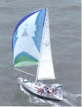
White Pepper left Hawk's Nest Marina on Cat Island at dawn on the high tide. We would miss the wonderful pool at Hawk's Nest Marina. The day was clear with a warm gentle breeze from the SE. As our course was NNW to Little San Salvador Island it was a perfect chance to set the cruising spinnaker. We had carried it from Texas and never used it. Today was the day. Finally after some tweaking and twiddling, especially with the sock, it popped open and fly beautifully all morning. I have a picture to prove it, but if is on film and not digital. Gentle readers will have to wait a while to see the pic, but I promise to show it eventually. About 1 pm the wind lightened so much we had to strike it and motor on.


Little San Salvador is small island conveniently located between Cat Island and Eleuthra Island. It is called Little San Salvador because it is little and next to Cat Island which used to be called San Salvador. In the early 20th century Cat Island had to give its famous name to Watling's Island or Guanahari. Cat Island then had to take the name of Captain William Catt, a British pirate.


We did not go ashore as the entire island has been bought by Holland Cruises and turned into a cruise playground. Cruisers are not welcome, esp if one of the cruise ships is anchored offshore.  I was able to borrow a picture of the 3 story pirate ship/bar the the company has constructed on the beach.  I guess this is to provide customers with an authentic Bahamian experience.


Contrary to published opinions, another cruiser said he went ashore and was welcome.  He enjoyed the day and could have even had a free lunch.

San Salvador Island


White Pepper finally reached San Salvador on Saturday, April 9, 2011 almost 520 years after Christopher Columbus first stopped here. White Pepper came from Rum Cay in a 41 foot sloop. We had to beat against a NE breeze. Columbus' ships were only slightly larger but came from the Azores running most of the way. Several alternative first landing sites have been proposed and the controversy will likely never be settled. However, the case for San Salvador is compelling. There are actually several small artifacts that link 13th century sailors with Arawak Indians. These are in a museum on Sal Salvador. We wanted to see these, but the museum is closed and under reconstruction. Columbus described the new island as bean shaped and filled with lakes both very characteristic of San Salvador. My favorite bit of evidence is Grahams Harbor, a well protected road stead on the northern shore. Columbus reported “a lake large enough to hold all of the ships of Christendom.” Grahams Harbor could easily fit that description. Columbus first anchored for the night on the rocky eastern shore.  This spot is marked by the Chicago Herald memorial placed there at the time of the Chicago World's fair.  A picture of the beach and memorial are below.


The next morning, Oct 19, 1492, Columbus moved around to the sheltered bight, on the western shore of this bean shaped island. White Pepper followed the same strategy anchoring off Cockburn Town in 9 feet of the clearest water and cleanest sand I have ever seen. Columbus anchored about 3 miles further south in Long Bay.  An underwater memorial marks the likely spot.  Pic below.


The colors of San Salvador are the most intense I have witnessed, especially the blues. I think that the reason is that the shore drops off so quickly. Only 200 yards off shore the water depths drop to thousands of feet. It would be possible to deep sea fish for marlin or sail fish with our dingy, Habenero. The water and air are as clear the Atlantic Ocean which exactly where we are. San Salvador is the very top of large mountain that comes straight out of the abysmal plain of the southwestern Atlantic Ocean.  This does not do justice to the drop off.


On Sunday the island was closed as is typical of the Bahamas. We did hike to the Riding Rock Marina Inn and had a wonderful lunch of cracked conch overlooking the reefs of Riding Rock Point. Monday we did chores. We dingied into the Riding Rock Marina where I got some diesel and Jan went on the get money at the bank. Then we shopped in Cockburn for supplies. I arranged for a tour of the island with Nat Walker. Nat is a bus driver and sometimes tour guide. He is an engaging, well educated and widely traveled Bahamian. He has come back to San Salvador to raise a family and help with the family bus business. On Tuesday as Nat drove us around the island we saw the vast calm expanse of Grahams Harbor and the marine science institute run by an American college. We stopped at the light house atop Dixon's Hill (elev. 79 feet) and climbed to the top. The light house is actually working and still runs on 1890's technology. Two families supply the lighthouse keepers who live on site. Here are pictures of the lighthouse some of the 19th century machinery still in use.


 The view from the top of the lighthouse gave a spectacular panorama of all of the northern coast but more interestingly of the vast systems of salty lakes that comprise much of the interior of San Salvador. This view is towards the north.  Graham's Harbor is in the distance.


 We drove along the deserted eastern shore. Only several families live on this stretch which once housed thousands in the plantation days. There is no electricity on this side of the island and any settlers are truly off the grid. On the southern shore we stopped at Watling's Castle which is an easily accessible ruin of a once successful plantation.  San Salvador was once called Watling's Island.


 The last stop on the tour was a visit to the Columbus memorials on Long Bay. There are several memorials grouped together. One was placed on the site by the Spanish government in 1992 to commemorate the visit by the Columbus fleet replicas. I may be mistaken by I believe that these are the very ships that were purchased by the city of Corpus Christi and now reside on the bayfront. Another memorial was placed by the Mexican government to commemorate the passage of the Olympic flame on its way from Greece to Mexico for the 1968 Olympics.  The small white cross is the "official" Colombus Memorial.  Note the catameran, Guiding Light, in the background.  Her owner, Shane, took these pictures and graciously let me publish them.


 On our last day we took Habenero to several snorkel sites. Moorings are maintained by Club Med so we did not have to anchor. After snorkeling we carried on the Long Bay and again visited the Columbus memorials for a picnic lunch. As we came ashore I claimed all of the New World in the name of Queen Jan. Seriously, Long Bay is a lovely beach with long stretches of soft white sand and would be a tourist destination without the history. There is good snorkeling just off the beach in warm shallow water. We had the entire place to ourselves. It did give me a tingle to imagine my footsteps crossing those of Columbus.


On Thursday we sailed west back to Cat Island sad in the knowledge that San Salvador was the high water mark of our cruise. Now we were head back to Florida although slowly.

Rum Cay


A new game to play with the advent of GRIB weather files is playing jujitsu with the wind. The problem is that sometimes the wind flips you back. White Pepper's plans was to go to San Salvador Island. The island lies about 60 miles ENE of George Town which is almost always up wind. One previous try had failed. Then I read a line in Mathew Wilson's cruising guide that the way to San Salvador goes thru Rum Cay. I hatched a clever plan. After Kathy and Robert Briscoe left us, Jan and I resupplied and moved the boat out the the Monument anchorage in Elizabeth Harbor to wait on the wind. Finally after several days a nearly perfect pattern was predicted on the GRIBs. First there would be a south wind to drive us across the Exuma Sound to Calabash Bay, an exposed anchorage on the northern tip of Long Island. However, the GRIBs called for calm that night. The next morning there would be very light northerly winds which even our motor could handle. After motoring around Cape Santa Maria on the northern tip of Long Island we would bear off to the SE and a light NE breeze would blow us to Rum Cay. At Rum we would anchor and wait for the wind to clock around to the SE. This wind would blow us up to San Salvador which lies 30 miles to the NNE of Rum. Good plan, and it almost worked out. When we got to Rum the wind went to the E and then backed into the NE and stayed there for days. Oh well, Rum Cay is a great place to wait out weather esp. wind from the north.


Port Nelson is not a port at all. It is the only settlement on Rum Cay. The island once supported 5000 people working in the salt pond trade. Now there are only several hundred souls on the island if that many. The pictures are of the Salt Pond and its entrance to the sea.  Port Nelson is an open bight fully exposed to the south and west. It is notorious in the cruising literature for rolling and going into the marina is advised. When White Pepper arrived the anchorage looked calm and after dodging a few scattered coral heads which were easy to see in the bright afternoon sunlight, we found a nice sandy spot in 12 feet of water to put the anchor down. We were comfortable there for our entire stay.


Rum Cay is a beautiful place, but there is not much to do. An hours walk did the town. Another hour was enough to walk to the small marina and check it out. All the stores were closed since the mail boat had not come in several days. The pic is of the closed Last Chance Store. We snorkeled a reef system called the Cottonfields, but did not see much. Another cruiser told us he dived on the extensive reef off Sumner Point, but he thought that most of the coral was dead. A big sun fish floated past the boat. Also on the reef is the wreck of the HMS Conquer.   It was the most advanced war ship in the British Navy until she cut the reef too  close in 1861.  Fellow cruiser, Shane, from  Guiding Light, took this picture of her drive shaft in 40 feet of water.  It was by the way the first such device in his majesty's service.


The most entertaining thing we did was to have dinner at Kaye's Restaurant. Kaye's is located at the foot of the government dock. Kaye is written up in all of cruising guides. She was not there that day, but her mother Doris did the honors. What started out as a dinner for Jan and I and our new friends Kate and Paul from Hylas 49, Ieolus, mushroomed into a a buffet dinner for 22. There was an extended happy hour. The buffet was worth the wait and very well worth the $15 Doris charged—conch, fish, ribs, spicy baked chicken, salad and johnnie cake. After dinner some of the locals did a few selections of “rake and scrape.” Rake and scrape is sort of music made on homemade instruments—cowbells, saws, wood block and drums made out of barrels. It was great fun in a primitive way.  The picture at the top is of Jan rocking out with cowbells during a rake and scrape number.

Wednesday, April 13, 2011

Fowl Cay, Elizabeth Harbour


One of the joys of having out of town company is being able to visit the old hometown's tourist traps with new eyes. Kathy and Robert Briscoe were visiting for 5 days. This was too short a visit to plan a sailing adventure so we hung out in Elizabeth Harbor which is the actual name of the vast road stead that cruisers refer to as George Town. The road stead is about a mile wide by 5 miles long. Elizabeth Harbor is bounded on the NE by Stocking Island and on the SW by the very large Great Exuma Island. Elizabeth Island, Guana Cay and Fowl Cay trail off to the SE. More about Fowl Cay later in the post. Conch Cut is the northwestern entrance and North Cut is the southeastern entrance (go figure about North Cut being off to the south).

During the visit we walked up and down the dusty main street. I learned that this is actually the Queen's Highway although no one ever calls it that. We visited the straw market and the better souvenir shops. We eat cracked conch and drank Kalik beer at Eddie's. Readers should translate cracked conch as deep fat fried conch which has been pounded vigorously. Please never order this dish in the USA or anywhere except the Bahamas. Without knowledgeable preparation conch is awful, but in the hands of a Bahamian it can be heavenly. I have never had any better than at Eddie's Edgewater Restaurant.

We walked the trails of Stocking Island. We looked for shells on the spectacular beaches of Stocking Island. We dallied at the legendary beach bar 'Chat and Chill' on Volley Ball Beach. But the fact is that the Sands Bar on on Hamburger Beach serves a much better hamburger.

However, what the Briscoes were interested in the most was good snorkeling. White Pepper usually snorkels at a little reef just south of Sand Dollar Beach, but it is tame fare. For more adventure we took the boat to an anchorage off Guana Cay (which is open but the weather was settled). The next morning we set off in the dink for Fowl Cay about a mile away. Fowl Cay is a small, uninhabited island near North Cut. We pulled the dink, Habenero, up onto a deserted isolated beach. There we had a light picnic lunch while waiting for slack water. Finally the time came to swim around the southern corner of Fowl Cay to the most amazing reef I have ever seen. It was only about 200 yards long and in about 4 feet of water. The reef was aflame with yellow and purple coral of many shapes and sizes. There were fish everywhere. It was like swimming in a well kept aquarium. Robert, looking under a ledge, found 18 empty conch shells. His theory was that this was the nest of an octopus who has dragged these small conch to his home and ate them at his leisure. We all quickly started to look for conch shells, and within an hour the four of us had rounded up 33 nearly matched perfect specimens of conch shells each about 3 inches long—quite a treasure. The next morning we took Habenero about half a mile north to explore the reef between Guana Cay and Elizabeth Island. There is a lot of reef here. I estimate a tall man could probably walk between the islands at low tide if walking on coral were allowed. However, this reef while better than average just could not compare with Fowl Cay. Unfortunately, it was here that White Pepper's usually reliable Olympus underwater camera leaked. It has never come back to life and many spectacular underwater shots were lost.

Many cruisers and scientist all over the world report that coral reefs are dying and threatened. I suppose this is true as I rarely see great coral in my travels. But at least in one small small corner of the Bahamas, Fowl Cay, there is a really great coral reef within in easy reach.
Cotton Grows on Little Farmer's Cay


It always feel good to be back on Little Farmer's Cay. After anchoring north of White Land Beach we saw old friend Johnathan on his Gulfstar 50 Calypso enter the harbor. We radioed; they had caught a large fish and invited us to share it. Johnathan took the fish into Brenda's who identified it as a Bonita tuna and offered to cook it up for dinner. While Brenda was cooking, the crews of Calypso and White Pepper sat outside of Ali's bar for cocktails. Ali is Brenda's spouse. Nearby was a large shrub with fluffy white balls—wild cotton. This was a bit of shock to White Pepper from South Texas where cotton is plentiful but grows in long neat rows and never gets more than one year old. This cotton bush may have gone back to the loyalists days. Loyal southerns tried for several years after the American Revolution to grow cotton in the Bahamas. The planters are gone, but the seeds remain.

Calypso headed north. Jan and I spent the next evening with old friends, Earnestine and Terry Bain at his Ocean Cabin Inn. Terry is always interesting. He is getting more involved in Bahamian national politics and is opposing the Aga Khan's development of Bell Island inside of Exuma Park.

White Pepper had her first anchoring failure during this visit. We knew the anchorage was tight, and I had even shortened scope to keep her in deeper water. But about 1 am on the night of the full moon and spring tide when the current went slack, the Rocna 22 anchor had dragged about 30 feet. This small distance put us over some rocks that were 5 feet deep at very low water. Jan and I awoke with a crunch and a jar—a very horrible feeling. Luckily were were not hard aground and could motor off with just a couple more gut wrenching bumps. I reset the anchor out in the deeper water. There was fierce current but no more rocks. The take home lesion is that all plow type anchors (even the redoubtable Rocna) drag a bit as they settle into the sand. This just has to be allowed for.

Next stop--back to George Town to pick up the Briscoes. Kathy and Robert were flying in for a short visit. Up anchor before dawn and out the cut at slack water. Then we had a brisk 38 n. mile ride to George Town on a nice NE breeze. We arrived in time to see some of the annual Exuma Music and Heritage Festival that celebrates local musical talent. Regrettably we were too tired to make it all the way to the 2 am close and decided to turn in early.