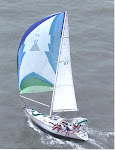

A new game to play with the advent of GRIB weather files is playing jujitsu with the wind. The problem is that sometimes the wind flips you back. White Pepper's plans was to go to San Salvador Island. The island lies about 60 miles ENE of George Town which is almost always up wind. One previous try had failed. Then I read a line in Mathew Wilson's cruising guide that the way to San Salvador goes thru Rum Cay. I hatched a clever plan. After Kathy and Robert Briscoe left us, Jan and I resupplied and moved the boat out the the Monument anchorage in Elizabeth Harbor to wait on the wind. Finally after several days a nearly perfect pattern was predicted on the GRIBs. First there would be a south wind to drive us across the Exuma Sound to Calabash Bay, an exposed anchorage on the northern tip of Long Island. However, the GRIBs called for calm that night. The next morning there would be very light northerly winds which even our motor could handle. After motoring around Cape Santa Maria on the northern tip of Long Island we would bear off to the SE and a light NE breeze would blow us to Rum Cay. At Rum we would anchor and wait for the wind to clock around to the SE. This wind would blow us up to San Salvador which lies 30 miles to the NNE of Rum. Good plan, and it almost worked out. When we got to Rum the wind went to the E and then backed into the NE and stayed there for days. Oh well, Rum Cay is a great place to wait out weather esp. wind from the north.


Port Nelson is not a port at all. It is the only settlement on Rum Cay. The island once supported 5000 people working in the salt pond trade. Now there are only several hundred souls on the island if that many. The pictures are of the Salt Pond and its entrance to the sea. Port Nelson is an open bight fully exposed to the south and west. It is notorious in the cruising literature for rolling and going into the marina is advised. When White Pepper arrived the anchorage looked calm and after dodging a few scattered coral heads which were easy to see in the bright afternoon sunlight, we found a nice sandy spot in 12 feet of water to put the anchor down. We were comfortable there for our entire stay.

Rum Cay is a beautiful place, but there is not much to do. An hours walk did the town. Another hour was enough to walk to the small marina and check it out. All the stores were closed since the mail boat had not come in several days. The pic is of the closed Last Chance Store. We snorkeled a reef system called the Cottonfields, but did not see much. Another cruiser told us he dived on the extensive reef off Sumner Point, but he thought that most of the coral was dead. A big sun fish floated past the boat. Also on the reef is the wreck of the HMS Conquer. It was the most advanced war ship in the British Navy until she cut the reef too close in 1861. Fellow cruiser, Shane, from Guiding Light, took this picture of her drive shaft in 40 feet of water. It was by the way the first such device in his majesty's service.

The most entertaining thing we did was to have dinner at Kaye's Restaurant. Kaye's is located at the foot of the government dock. Kaye is written up in all of cruising guides. She was not there that day, but her mother Doris did the honors. What started out as a dinner for Jan and I and our new friends Kate and Paul from Hylas 49, Ieolus, mushroomed into a a buffet dinner for 22. There was an extended happy hour. The buffet was worth the wait and very well worth the $15 Doris charged—conch, fish, ribs, spicy baked chicken, salad and johnnie cake. After dinner some of the locals did a few selections of “rake and scrape.” Rake and scrape is sort of music made on homemade instruments—cowbells, saws, wood block and drums made out of barrels. It was great fun in a primitive way. The picture at the top is of Jan rocking out with cowbells during a rake and scrape number.
No comments:
Post a Comment