Monday, February 24, 2014

Northern Creek of Shroud Cay


Entrance to northern creek in Shroud Cay

Shallow Part near the Entrance


Interior of Shroud Cay is all sand and mangroves

Creek opens out in Exuma Sound

 Ocean beach adjacent to the creek

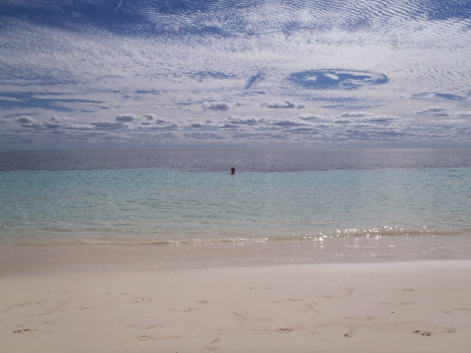
Picture does not do justice to drama of frontal clouds

Friends Daniel and Lucy seen on Allen's Cay


Shroud Cay, a part of the Exuma Land and Sea Park of the Bahamas, is a magical place. It is not inhabited and is preserved as a nature reserve. Most of the interior is tidal mangrove swamps interlaced with shallow creeks. One of these creeks, the northern most one, transects the cay from banks to ocean (actually Exuma Sound). It does not have a name that I know of.

White Pepper with buddy boat Gizmo I took on the challenge of crossing the cay at low tide. We had to “portage” the dingy for a bit, but the creek became deeper in the interior. Reference to the “African Queen” were inevitable although only short mangrove lined the creek, not jungle. There was abundant fish in the creek as they are under the protection of the Park.

With persistence and grit we did eventually gain the opening of the creek to the ocean. We were rewarded with possibly the most spectacular scene in the entire park. I was certainly impressed as the jungle scene gave way to an expansive white beach of the softest sand imaginable. The isolation and solitude was like something out of the Creation. After exploring the beach we climbed the dunes and were rewarded with a remarkable panorama of the island's interior. Mostly dry at low tide, it was rapidly filling up on the flood. I missed the picture because the camera's battery died. On this day the drama was increased beyond the usual by the passing of a weak cold front while we were on the beach. Dramatic clouds roiled overhead. The temperature dropped 10 degrees. An absolutely still emerald green sea began to ruffle in the new wind. The creek went from a gentle meander to a rushing stream as the tide rose and pushed water in from the sea.


The trip up the creek took at least 45 minutes motoring most of the way. The trip downstream was a sleigh ride of 10 minutes. We were spit out out onto the shallow banks (2 foot maximum depth) surrounding the cay. On the trip back to the boats I thought that this was one of those “bucket list” moments even though none of us had been prepared in advance for the experience. The northern creek on Should Cay is truly one of natures wonders.

Allen's Cay Revisited


White Pepper revisited Allen's Cay in the northern Exuma chain, Bahamas, in February 2014 after a hiatus of 6 years. What impressed us were the similarities between the two visits. Sensitive readers may want to review that post from January 2008. I did and was amazed at how casual I was then about a delay of several hours. Also I downplayed how awful that first night at anchor was.

The most impressive similarity was the nights of terror. Allen's Cay was our first landfall in the Bahamas without crew. We were alone in 2008 and very naïve. The anchorage we chose then was too close to the rocks and in too much current. The wind was strong. The anchorage was crowded as always, and I was on short scope. I spent all night awake on anchor watch in a frightful night largely made of my own device. This time in 2014 the terror was all Mother Nature. We knew a front was coming and indeed that is why we chose Allen's Cay. Allen's has excellent protection from the W and SW. This front was predicted to have especially strong W and SW winds ahead of the front. The prefrontal trough often brings squalls along with the W wind. Again there was a crowd of about 18 boats. This time I chose the anchorage more carefully—in deep water with more current but more room. I set the Rocna anchor with all 100 feet of chain and 20 feet of rope. About 2 am a squall blew in at 40 or 45 knots from the W. The Rocna pulled out. I felt the White Pepper drag about 50 feet before resetting and holding firm. Add another one to the legend of the Rocna anchor! I started the motor and used half throttle to face the wind and blinding rain until it ended as suddenly as it stated 20 minutes earlier. About 5 am another squall blew in and sent the White Pepper skittering to the end her tether where she held firm. I was able to get to sleep about 7 am.

All in all, the night was the diciest we have ever spent in the Bahamas. Almost every boat in the anchorage drug. Three ended up on the beach and several were planted in the sandbar that bisects the anchorage. My neighbor went by me so fast I thought he would be swept out the cut into the sea. Fortunately, no one was hurt, and I did not hear of any serious damage.

Other similarities of the two visits are the importunate iguanas. These Iguanas are unique to Allen's Cay and to the Bahamas. They are also spoiled rotten by the tourists. If not fed, they will try to bite.

The austere landscape and amazing emerald tinted crystal clear water are enduring and enchanting.  One thing that we did find was a conch hatchery.  See the picture below. There is concern recently of overfishing and exporting of conch.  There is a real possibility that the conch fishery will collapse in the Bahamas as it has in Florida.  At least in Allen's Cay there seem to be plenty of conch.

What is different is the vast experience Jan and I bring to the 2014 visit. What was exotic and intimidating in 2008 is now familiar (squalls excepted). However, this year we are buddy boating with Lucy and Daniel on Gizmo I, a Hunter 37 from Montreal. They are new to cruising. Days that seem merely pleasant or delightful to us are amazing to them. Allen's Cay is their culmination of a 10 year dream and a 1000 mile voyage. It has been wonderful to see the Bahamas again through fresh eyes.


After all the excitement we stayed several more days waiting for a secondary front that did not show up until we had left for Shroud Cay.

 Jan usually drive the dingy.  West wall in background.

 Shameless Iguana begs for food.

 Conch hatchery.  All these shells are alive.

 Live Tulip shell found in 4 feet of water.

Amazing water colors

Monday, February 10, 2014

Little Harbor, Berry Islands--The Cabbage Island Anchorage

From Great Harbor to Little Harbor in the Berry Islands is an easy 22 n.mi. day sail. The entrance is deep and wide open. There is a selection of anchorages. The recommended anchorage is to the south behind Frozen Cay. Frozen Cay used to be called High Cay only a few years ago (including on my old Map Tech charts). This day White Pepper chose the anchorage behind Cabbage Cay because we wanted to be closer to the settlement at Little Harbor (more about that later) and because the weather was quite settled.

This latter fact was quite important as the anchor never bit. The ground looked like sand but acted like rock. None of the three boats in our anchorage ever got a set. However, the wind was so light that we lay to the chain for two days. The anchorage was a bit rolly. It was nothing too uncomfortable. I could see that in any kind of weather things would get really out of hand. The take away lession here is that I can not recommend the Cabbage Cay anchorage.

Little Harbor proper has a recommendation as a hurricane hole if one can tuck in close to the settlement. However, the depth is so shallow that one would have to wait for the storm surge to get in. If White Pepper ever comes this way again, she will opt for the remote Frozen Cay anchorage.

Eventually we did get into the “settlement” and to the famous Flo's Conch Restaurant. We were fortunate to meet Flo's daughter. She told us that her mother had passed three years ago. Her brother and his wife ran the restaurant. These were only two people left on the cay that had supported several families and 50 people in years past. She and her sister worked as personal assistants (nurses' aides) in the USA. We walked around the place. It was a compound of about an acre with cistern, generator, chickens, and geese. There was no road and no path to anywhere. There were enormous piles of conch shells along the shore that represented maybe 50 plus years of harvest. I found it remarkably isolated even by the standards of the Bahamian out islands. Soon enough no one will live here.


On a more cheerful note the conch lunch and Kalik beer were delightful, if overpriced. But one has to consider the effort required to hold back the bush in the price of the food.

 Carved Conch Shell

 Deserted Beach

Flo's Back Yard
Flo's Famous Conch Restaurant


Little Harbor 

Don't Try This at Home, Folks--Great Harbor, Berry Islands

Sunrise Great Harbor, Buddy Boat Gizmo in Foreground

The major problem with entering the Bahamas at Port Lucaya on Grand Bahama Island is that you need a weather window to leave. It is 55 nautical miles to the nearest Berry Island, and that is due SE into the teeth of the prevailing winds. White Pepper had a good window to leave in front of a stationary cold front. Winds were predicted to be light from the south or southwest and seas calm. We cleared the jetties at dawn at 7 am. Indeed the morning started out exactly as predicted. We made good speed with gentle breezes abeam or just forward of the beam. Trimming the sails precisely for a close reach on starboard and motoring we were making good progress. In the afternoon the winds stayed light but gradually veered to the ESE which made a head wind. The motor got so hot I had to back off to avoid starting a fire on the boat. Eventually, the wind came around enough to reset the genoa on a port board. However, by this time our window for a daylight arrival had expired. We arrived at the Great Harbor waypoint at 7:30 pm about an hour after dark.

Conventional wisdom, endlessly repeated, is to never enter a strange port at night. Countering this ancient and sound advice was a powerful desire not to spend the night at sea. Also in our favor was a bright moonlight, calm seas, and almost no wind or current as it was slack water. The opening is about 300 yards wide which is quite large by local standards. Great Harbor is an old and historic harbor for ships transiting the Gulf Stream and Bahamas. It is tucked up between Great Stirrup Cay and the northern tip of Great Harbor Cay. It gets poor reviews from the cruising guides, but who cares about surge and current when the alternative is the deep blue sea of the Northwest Providence Channel at night.

The Garmin chart plotter was spot on guiding White Pepper through the opening and to a safe anchorage in 10 feet of water. The land was dimly visible in the moonlight. There were, of course, no aids to navigation. Later, after celebratory rum, I thought that isn't this the way we enter all anchorages nowadays—with eyes glued to the chart plotter? Aren't all landings just instrument rated landing even in visual rated conditions?

Just because we got away with it I do not recommend entering Great Harbor at night. I would , however, take the same window again if it comes up. But next time I will leave Port Lucaya at 4 am.

Finally, what's a good sailblog worth without a cute kitty picture?

Aphrodite

Sunday, January 26, 2014

Car Trip to Eastern Grand Bahama Island

Deep Water Cay from MacCleans, Grand Bahama Island

Our Bahamian friends, Paula and Don, took us for a lovely Sunday afternoon tour of the eastern side of their island, Grand Bahama Island.  To be truthful, the interior of the island is desolate, undeveloped scrub and scrawny second growth pine.  The island was heavily logged in the mid 20th century.  

First stop was at the Lucayan National Park where we got a hint of what the island may have looked like originally. This stuff was impenetrable without trails. The Bahamians use the word coppice to mean ecosystem.  (The English use a different meaning.) The rocky coppice is occasionally flooded at high tide.  

Discussion of the Rocky Coppice

Example of Rocky Coppice

We crossed a wonderful salt water creek with hundreds of fish visible in the shallow, clear water.

Salt water creek in Lucayan National Park

My shadow (lower left) taking a picture of large mangrove snapper

Several hundred yards further on brought us to the lovely Gold Rock Beach on the southern shore of the island. The very deep water Northwest Providence Channel in the background.

Gold Rock Beach looking East

Gold Rock Beach

Then we motored on to the town of Pigeon Settlement and past the homemade light house of the Light House Church of the Later Day Saints. It later showed up on the label of a local beer much to the dismay of the church.

                                 Light House in distance, may need to click on pic to see.

The eastern most settlement on Grand Bahama Island is MacCleans (sic).  We had driven about an hour or 50 miles from Freeport. MacCleans has a daily ferry to Abaco Island and several very neatly kept houses, churches, school and a clinic.  We found a local restaurant, E. J.'s Bayside Cafe,  and were delighted with the cracked conch and the service.  Here is a pic of us outside the restaurant. In the unlikely event that you are passing this way (and it is far off the beaten path), I can highly recommend the food.
Karl, Jan, Paula and Don at E. J. 's


Friday, January 17, 2014

Port Lucaya in Winter

Why has White Pepper taken a slip for a month at Port Lucaya Marina, Grand Bahama Island, while our Canadian friends bravely battle their way South down island this January?  "Because it's the Winter, Mon."

Yes, January is winter in the Bahamas and one cold front after the other whistles overhead.  This week alone we have had cold fronts on Thursday, Saturday, and Sunday.  Here is a pic of Jan swimming on Friday with a very wintery sky overhead.  Note the cirrus and scabrous clouds.
Winter Sky, Warm Water

This week has brought days of sustained westerly and northwesterly winds that render the traditional Exuma anchorages uncomfortable or downright untenable.  And I feel sorry for the Abacos sailors where protection from the west is rare.

All is not lost, however,  we follow the cruise ships that frequent Port Lucaya.  Here is the massive Costa Luzencia in the background. There is always live entertainment in the Port Lucaya village whenever a cruise ship is in port or offshore.

We attended a fish fry with out Bahamian friends Paula, Don and daughter Megan.  Megan is a freshman in medical school in Trinidad. I will play golf with them later this week.
Megan, Paula and Don
Also, new friend and slip neighbor, Dennis, has been catching wahoo. He gives us a few pieces.
Dennis and wahoo

We walk, shop, and kayak.  Most of the boat chore are caught up by now. In February when the fronts slow down we will head South.

Saturday, January 11, 2014

Majority Rule Day

January 10th has always been important to the Bahamians.  On that day in 1967 they voted in the first free and fair election in Bahamian history.  Majority (black) rule soon ensued.  The day is even more dear to them than Independence Day on July 10th.  2014 was, however the first time the day was celebrated as a legal holiday, and White Pepper was pleased to participate.  First we met our friends from Grand Bahamas, Don and Paula von Hamm.  Don is a semi-retired professor of history at the local college in Freeport, and Paula works in real estate. Alert readers will remember Paula from my post in April 2011 "Easter at Rock Sound."
The von Hamm's with Jan

We all headed for downtown Freeport where speeches and marches were underway.  Here is the Fire Department Marching Band.

                                                           Fire Department Band

Don and Paula let us go early as today was our 10th anniversary (observed).  Actually our anniversary was January 2nd. We were pinned down in Lake Worth, FL waiting out a cold front and could not get off the boat.  We celebrated 10 wonderful years of adventure at Cappuccino's--a surprisingly good Italian restaurant in the Lucaya Village.
Tenth year anniversary

The menu was grilled scallops, blue cheese gnocchi, salad, grilled wahoo, and Tira Missou.  Here's to 10 or 20 more years.