Wednesday, March 23, 2011

Mount Alvernia, Cat Island, Bahamas


There is little reason to visit New Bight, Cat Island, Bahamas except to pick up a few supplies or to visit the hermitage of Father Jerome on top of Mount Alvernia. White Pepper's reason for stopping at New Bight was to spend a few days waiting in the lee of Cat Island for the wind to moderate while not paying the big slip rent at Hawk's Nest Marina. The hike up the hermitage was a wonderful bonus.

First a word about the geography then I will add a paragraph about the remarkable Father Jerome before describing the actual hermitage. Mount Alvernia was the name Father Jerome called this hill. The official name is Como Hill. It is the highest elevation in all of the Bahamas at 208 feet. From this peak one can see the cobalt blue of the Atlantic Ocean to the east, the turquoise of the banks to the west, and the endless unbroken green scrub forests of Cat Island stretching out to the north and south. Father Jerome had an eye for the spectacular.

Father Jerome was born John Hawes in England in 1876. He studied architecture and then switched to an Anglican seminary. He came to Long Island, Bahamas and built several remarkable churches. Apparently a restless soul, he made a switch to Catholicism in 1911. After seminary studies in Rome he spent 25 years as a bush priest in Australia. In retirement he received permission to spend the rest of his life as a hermit on Cat Island. In 1939 he chose Mount Alvernia and spent the remainder of his life alone on top of this hill. There he built by hand from native materials a miniature version of a monastery after the rule of St. Francis of Assisi. He was buried there in a simple tomb in 1956.

What is remarkable is the proportion of the structure. It is so well designed that from the anchorage it looks like a castle high on the hill. In actuality it is the size of a modest home. Indeed it is almost a doll house. Father Jerome must have been a small man. I could barely fit inside of the chapel, and I could not possibly fit in the one chair and kneel-er in the chapel. The bell tower could not be more than 13 feet tall. There is a tiny living quarters which connects to the chapel with a short tunnel. I guess that way he could say Mass even in a storm. Near by is a cistern and sun dial. The last 50 yards of the trail to the hermitage are almost straight up and lined with 12 home made Stations of the Cross. There is one out building for what purpose is not clear. About 100 yards away and down a well marked trail there is a large cave. I am sure Father Jerome spent some years in that cave before his living quarters were completed. The entire site is a remarkable testimony to one man's faith and choice of life style. Fortunately, the Bahamians know what a treasure they have left to them and are taking good care of the place.

Less well cared for is the old great house of the Armbrister plantation. It is at the foot of the road to Mount Alvernia. Built in 1760 it dates to the pre-loyalists days. The house along with Master Armbrister was burned in a labor dispute with his slaves about 1830. In some ways the ruin is a fitting icon for Cat Island. The place is a disconcerting blend of derelict buildings right next to brand new construction.
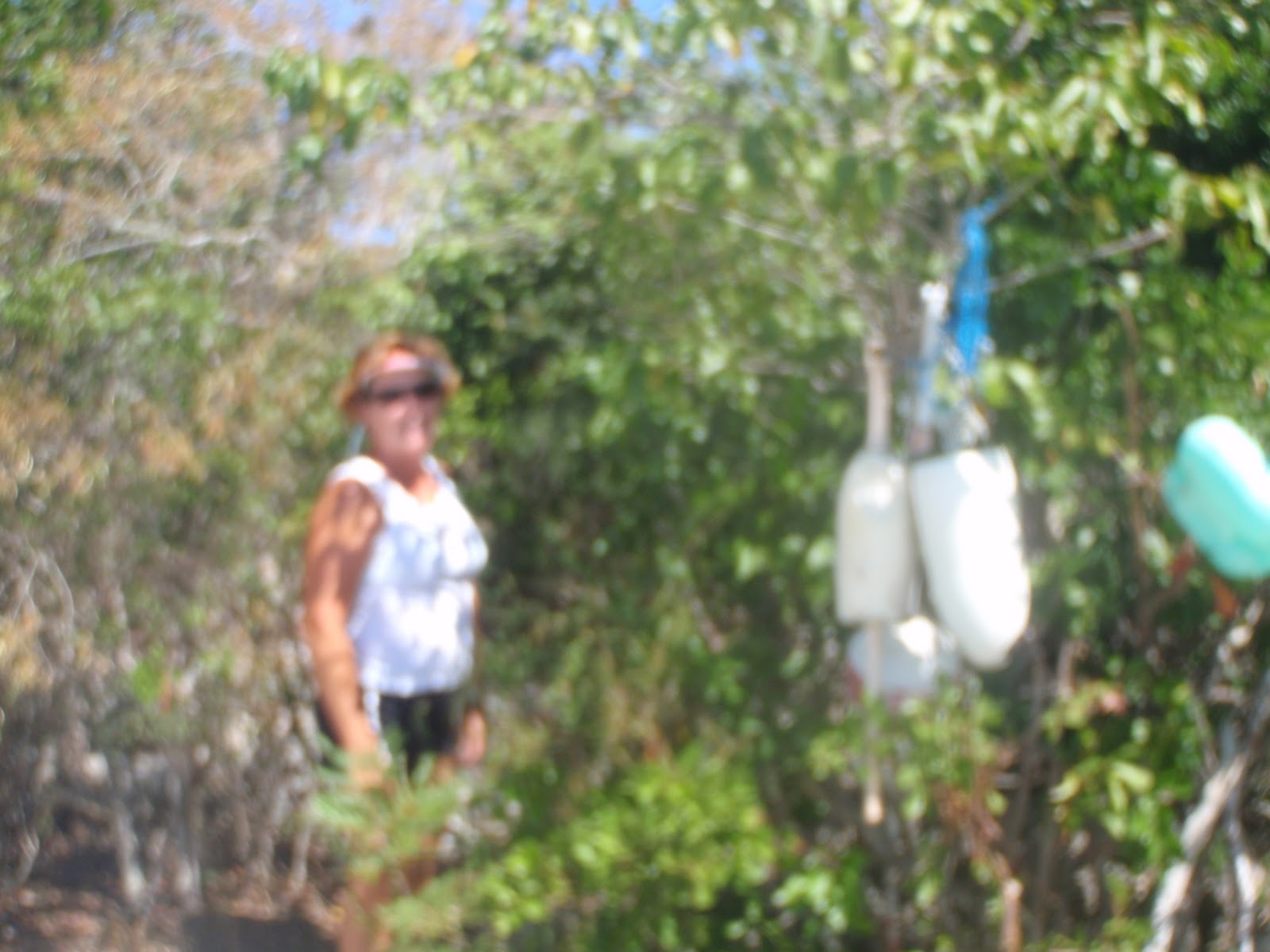
Other good things about New Bight are wonderful, open people. Mrs. Olive sold us two loaves of heavenly coconut bread. The Necker sisters served up a delightful Bahamian lunch at the Blue Bird Cafe.

After several days the wind had clocked around to the SE. We set sail across the Exuma Sound back to Little Farmer's Cay, Exumas. We had a rollicking sail with 15 knots on the port quarter. Waves built to about 5 feet but calmed down in the late afternoon. Eventually we put anchor down about 100 yards from where we were two months previously.

Hawk's Nest Creek


White Pepper needed a break. We had not stayed in a marina since Nassau in January. However, there was a strong north wind coming, we needed to fill the water and fuel tanks, and I needed several hot showers and some quality time on the internet. Hawk's Nest Marina is located at the very southern tip on Cat Island. If Cat Island looks like a slender lady's boot. Hawk's Nest Creek is at the toe. It is the only marina on Cat Island. The creek's entrance is very well marked and deep by Bahamian standards. The marina is just past the entrance. The protection is total, and I would feel safe there in all but the very worst storms. The Tartar banks are only two miles away and the place is renowned for great deep sea fishing. We did not catch anything. The marina is expensive. However, with the slip comes numerous amenities—clean showers and bathrooms, laundry, use of the club and pool, use of the honor bar and all day internet and cable TV, bikes to ride, and kayaks. The Hawk's Nest club runs a private air strip. We saw several planes take off and land every day. The air strip is between the marina and the club house, so we had to stop our bikes and look both ways before crossing over the strip.
The kayaks were the high light of our stay. We took a good quality Ocean brand double seater with canvas backs and good paddles. We left the marina about an hour before high tide and rode the last of the flood tide up Hawk's Nest Creek as far as we could. When the water level reached six inches we had to turn around and paddle back. We could have waited for the ebb to carry us back an hour later; however a pre-frontal rain squall was brewing so we hurried back. The creek was spectacular, but it did not have the amazing life that was in the creek at Conception Island. All we saw in the water was a starfish and two good sized sharks. Jan got a picture of one sharks that was about three feet long in less than one foot of water. We thought it was a nurse shark, but could not be sure.
Hawk's Nest is a treasure, but it is isolated and remote in the extreme. There is nothing else about for miles. There are a few homes along the shore and that is it. No store, no straw market, no bar, no restaurant, etc. One of the guide books called it “back of beyond.” Finally, when the wind abated a bit and clocked around to the NE we were ready to leave.
Departure day brought 20 knots of wind. Water depth was about 20 feet. Our destination was 10 miles dead to weather. Using the previous analogy about Cat Island looking like a slender boot, the Bight is the part in front of the ankle. There was no way White Pepper's tired old engine could motor us upwind. We had to sail for it. Since the wind had clocked into the NE Cat Island provided a lee and the water was flat. We set a reefed main and reefed genoa. The old girl showed her racing heritage charging upwind at 6+ knots. We tacked on headers. Instead of dipping starboard tackers we dodged gnarly looking coral heads. Finally when the anchor rattled down in 9 feet of water over clean sand we were rattled ourselves for having violated cruiser's rule #1: gentlemen and women never go to weather.
However, after a rum drink Jan and I decided this day would have been an excellent day sail in Texas. 

Friday, March 11, 2011

Conception Island


 When God returns to Earth He will not chose Jerusalem. Rather He will set his throne upon Conception Island, Bahamas. That way He will not be as homesick for Heaven. And if only a few humans come to visit, there are plenty of turtles about; even better.

Conception is a small island about 15 miles NE of Long Island. We motored over from Long Island in a glassy calm. We easily avoided the two large reefs that protect the anchorage and dropped the hook in 13 feet of water in clean sand. The island is part of the Bahamas National Trust and is a national park similar to the Exuma Park. Shelling, hunting, setting fires, and dumping trash is forbidden. Fishing is allowed. It is uninhabited and there are no buildings. It is pristine. There is not even much plastic debris on the eastern beaches and the western beaches are completely clean. This island is the most naturally beautiful place I have ever seen!


However, most amazing reason to visit here is to see the turtles. There is an tidal creek that runs through the interior of the island. Access is only available at high tide, but once over the rocky bar, the creek winds back into the island for over a mile with 1 to 4 feet of water. Dozens, if not hundreds, of sea turtles live in this protected environment. Near the end of the creek there is a deep pool of dark green water about 300 feet long, 50 feet wide and 10 feet deep. It is lined with lime stone and mangroves. We anchored and tried to stay as still as possible. Numerous turtles kept popping up to take a look at the visitors. It was a magical moment. Motoring slowly further upstream in about 3 feet of crystal clear water there were manta rays and small sharks as well as more turtles swimming under the dingy. Jan and I were amazed at how fast the turtles streaked away from the boat. They literally fly through the water moving their flippers like wings. Eventually the tide started to ebb, and we had to return or risk staying for another 12 hours. We floated down the creek carried by the wind and tide.


As the mangroves, yellow-white sand bars, and limes stone slid past with the blue sky over head and wind whistling I felt that I was not even outdoors but rather in some sort of futuristic, super realistic Disney ride. The sensation was that unreal.


On other days we hiked along the beaches. The view from the cliffs over looking the reefs is so mesmerizing that we would often spend 10 to 20 minutes just looking from one spot. From one of the promontories we could look inland to a drying lake, a salt pond. Over about an acre there was a shallow half dried lake orange- red in color. In the middle of the lake was a solitary white egret. The bird was fishing in a dainty manner so different from its Texas cousins. Here the egret did not have to keep one eye open for predators. The difference was apparent even from a distance. By this time the camera battery had died, but what a picture that scene would have made. A favorite overlook of ours is from a large rock that requires a fixed rope to climb. We had a wonderful picnic on top of this rock. Several pictures are from this spot. On a deserted beach Jan found a colony of living cittarium and numerous chitons. The cittarium look like black and white nautilus shells. How amazing to see living “sea shells!”

Snorkeling is said to be wonderful here at Conception Island. We did not have time enough to do any swimming or snorkeling. A front is due in and have to seek shelter elsewhere. Before we left we had a wonderful evening visit with new friends from Mad Cap and Sabbatical. Both are Canadian yachts. Regardless of nationality we all shared a deep regard and respect for the amazing island just off our bows.

Post 108, Long Island, Bahamas


 About a mile north down the Queen's highway past Tryphema's Club Thompson's Bay there is a telephone pole with little silver numerals-108. Some cruiser's refer to this spot as mile post 108, but that can not possibly be correct. Long Island is only 90 miles long and besides this spot is the middle of the island. Other boaters have festooned the spot with colorful buoys to alert the traveler that this post marks the start of a trail to the ocean beach.

The trail is well marked. It passes through scrub and is heavily scented with goat's urine. Much of the trail is sharp limestone and takes a toll on Crocs or flip flops. It winds about half of a mile to a “summit” of probably 150 feet. The view of the blue Atlantic Ocean to the east and the green Bahama Banks to the west is spectacular. The trail then quickly descends to a lush forest and over an old stone wall. Locals call these ancient stone walls 'margins.' They mark old land boundaries. Along with the rest of the land they have been left unattended for decades, if not centuries. In the small forest were the largest butterfly and the smallest birds I have ever seen. The birds were some sort of finch and would have left room in a shot glass. Desiccation does strange things to nature.

The ocean beach at the end of the trail is as breathtaking as it is uninhabited. The ocean waves crash over and around sculptured limestone and was up onto the softest finest sandy beach anywhere. In the water is every imaginable shade of blue-green and turquoise.

Typical of beaches these days that are neglected and uninhabited there is plastic debris everywhere. Most of the plastic is above the high tide mark and is in the surrounding sea grass. Jan and I saw plastic grates and grills, floats, crates, and bottles, jugs and jars of every size and shape. There was both a baby's car seat and a child's toy car. There was very little glass thankfully. Most worrisome was extensive netting that seemed a danger to larger sea life. We dragged several specimens well above the high water mark. At least the stuff won't float back out to sea. There was enough trash to fill several large dumpsters. At this point most blogs would denounce the evil polluters, careless trash tossers, and every one who uses plastic products. But if the Bahamians can not pick up their beautiful, remote beaches, neither can I. And why ruin an otherwise wonderful day at the beach with plastic angst? Besides I can not believe that the plastic will last long if left exposed to the tropical sun. Nothing plastic exposed to the sun lasts more than several years on the deck of White Pepper. We did pack out a few beer bottles. They will be disposed of back in George Town, Great Exuma.

From the high water mark sloping well out into the ocean is the softest, cleanest, finest white sand imaginable. Jan found some prize sea shells. We picnic-ed and swam in the shallow end. By the time we had hiked back out, down the Queen's highway, back across the trail to the dingy and landed back on the boat, we had had quite a day at post 108 beach.

The pictures are a visual depiction of our walk to and from post 108 beach.


Tryphema is Slowing Down


The best reason to cruise to Thompson's Bay (also known as Salt Pond) on Long Island, Bahamas is to spend an evening at Club Thompson's Bay. The proprietress is Tryphema Knowles, a redoubtable figure and a great cook. To get to the club we have to dingy ashore, secure the dink to a scrub tree, hike through some scrub on a goat trail past a well to a dirt road, follow the dirt road to the highway and hike another quarter mile to her club. In 2008 Tryphema told me she was born in a home about 100 yards from that well. She still owns the land we hike across.

On this visit one of the cruisers had organized a get together for the boats in the bay. The weather had brought about 30 yachts into Thompson's Bay. There was room for 30 more at least, but it did resemble the crowding at George Town. Almost everybody made it in, and Club Thompson Bay was hopping.


Tryphema was in the kitchen chopping and pounding conch. I was struck how much she had aged in the three years since Jan and I were there. Even though she is likely in her 50's she looked considerably older. She free admitted that the gout was getting her down. One of the boaters said that she had knee surgery in Cuba recently. I noticed that she spent some time sitting which is unusual for her. Dinner was about an hour late. No one minded since the rum punches were flowing freely along with the usual cruising braggadocio. When dinner came it was worth waiting for-- a total Bahamian experience—cracked conch, grouper fingers, ribs, mac and cheese, peas and rice, fried plantains, plain rice, chicken wings, etc.

After dinner Tryphema came out for a round of applause and some happy testimony. Later there was talk about the club making a come back and needing new investors. I do not know what is happening there, but I do not think the future is bright at Thompson's Bay Club. Regretably, my pictures of Tryphema and her husband did not turn out.


I sincerely wish the best for Tryphema. She represents what is best in the Bahamas cruising experience. However, the future of central Long Island yachting seems to be coalescing about Long Island Breeze. Mike offers a floating dock, a daily net on the VHF, all day wi-fi, showers and laundry, spectacular view as well as good food and cheap beer. Even these amenities may not be enough to float the boat. Long Island is a desert and will always be limited by lack of water. For example, laundry and showers are by appointment at Long Island Breeze and are often canceled when the water supplies are low. Until the government of Bahamas is able to supply Long Island with r/o water (reverse osmosis), I doubt that any development will thrive in the Thompson's Bay/Salt Pond area.

Thompson's Bay has a lot to offer—a deep water route to the Ragged Islands and Cuba (well 7 feet at least by way of the Comer channel), great holding in 7 feet of depth with a clean sand bottom, about 270 degree protection (it is open to the southwest) and a pristine environment. It offers a reasonable alternative to George Town as a winter hibernation spot. But as I mentioned above water is the key. As long as George Town offers free pure r/o water she will always keep the cruisers.

Tuesday, March 1, 2011

Hangin' in George Town


White Pepper has been in George Town, Great Exuma Island, Bahamas for over 3 weeks now.  I have not made a post because so little happens here. So I thought I would write about a typical day aboard and ashore.

First of all we sleep late but wake up in time to make coffee and listen to the 'net' at 8 am.  The net is an endless round of routine announcements, but it is useful to find where the pot luck supper will be that day.  Also new arrivals are interesting.  Jan cooks breakfast.  My favorite is a bowl of cheesy grits with an over easy egg on top.  That will keep me smiling all morning.  Jan's favorite breakfast is French toast made with homemade coconut bread that we buy ashore. Then we might dingy into town for a bit of shopping, pick up water, do Internet, or just shoot the bull at the dingy dock with other cruisers.

About noon we dingy back over across the road stead to "Chat and Chill" on Volleyball Beach.  They make a great burger for a reasonable price. The picture is of Jan and Philip outside Chat and Chill. While letting the lunch digest we take in some sun, watch the kids play volleyball, and shoot some more bull with the cruisers.  After lunch we can hike across Lee Stocking Island to the ocean side for a long walk on the beach.  At low tide on the beach there is a rocky pool warmed by the sun that is ideal for taking a salt water bath and shampoo.  Back on the boat we have a quick fresh water rinse.

About sundown we can either go into the beach for a bonfire/pot luck/mixer or just relax with a sundowner as the sun sets over George Town.  I either grill or Jan cooks dinner.  Fine dining is not realistic here, so most meals are on the boat.  After dinner we often star gaze, esp. on moonless nights, or play cards.  Then its off to bed early.

That's pretty much it every day.  We can tell that the weeks go by because Beach Church is every Sunday and the propane truck (see pic) comes on Wednesday.  On the few calm days we can snorkel.  Lately the wind has blown so hard that the water is turbid with sand and snorkeling is not good.  Some of the younger set goes into town at night to honky tonk at the few bars about.  The older set goes over to the hotel to play trivial pursuit or Texas hold'em poker ($5 buy in).

Our friend, Philip Emmanuel, came to visit last week and got to enjoy all of this.  We had planned to sail off to a nearby island, but the wind was too strong for comfortable and safe sailing.  One one day we did circumnavigate Lee Stocking Island, a day sail of about 25 miles.  We managed to have an enjoyable week without much adventure.

The wind will lay down for two days soon and White Pepper is off to Long Island, Conception Island, and San Salvador.  At San Salvador we want to see what stirred up Christopher Columbus in 1492.